Where is mt everest?
BingMag Explains where is mt everest
Lost on the Map? Let's Find Mount Everest, Together
Introduction: Just Looking for a Straight Answer
Have you ever had a question that seems simple, but the more you search, the more complicated it gets? You type "Where is Mount Everest?" into your computer, expecting a quick, clear answer. Instead, you're buried under maps with strange names, articles about geology, and lists of climbing gear. It can feel a little overwhelming, as if you've stumbled into a club for expert mountaineers when all you wanted was a simple piece of information. I understand that frustration. So, let's put away the confusing charts and technical jargon. I'm here to be your friendly guide and give you the clear, simple answers you've been looking for.
The Simple Answer to Your Big Question
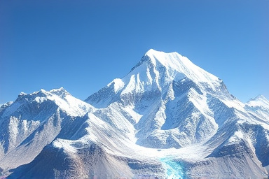
So, where is this world-famous mountain? Mount Everest is located on the border between two countries: Nepal and China. Imagine a giant, snowy pyramid standing so tall that its peak marks the exact line separating the two nations. The southern side of the mountain is in Nepal, while the northern side is in a region of China called Tibet. It’s part of a massive and beautiful mountain range called the Himalayas, which is like a giant, wrinkled spine stretching across Asia. When people talk about climbing or trekking to Everest, they are usually talking about going to the Nepali side, which is more famous and accessible for visitors.
A Quick Look Back: How a Mountain Got Its Name
For centuries, the local people of Nepal and Tibet knew about this majestic peak. They had their own names for it, which are still used today. In Nepal, it is called Sagarmatha, which beautifully translates to "Goddess of the Sky." In Tibet, it is known as Chomolungma, meaning "Mother Goddess of the World."
The name "Everest" is actually quite new. In the 1800s, a British team was surveying India and the massive mountains to the north. They identified this peak as the tallest in the world. In 1865, they decided to name it after Sir George Everest, a British surveyor, even though he had never even seen the mountain up close. So while the world knows it as Everest, it’s lovely to remember the more ancient and poetic names given to it by the people who have lived in its shadow for generations.
Ways to See the Mountain: It's Not Just for Climbers
When you hear "Mount Everest," you probably picture people in thick jackets with ice axes, struggling to reach the summit. But that's only one tiny part of the story! There are many ways for regular people to experience its beauty, and most don't involve risky climbing. Here’s a simple breakdown:
| Way to Experience Everest | Who It's For | What It's Like |
|---|---|---|
| Scenic Flight | Anyone! Great for those with limited time or mobility. | A one-hour flight from Kathmandu, Nepal's capital. You get a guaranteed window seat to see Everest and the surrounding peaks from the sky. It's breathtaking and requires no physical effort. |
| Trekking to Base Camp | People with a good level of fitness and a sense of adventure. | This is the most popular option. It's a journey of about 12 days, walking through beautiful villages and valleys. You don't climb the mountain, but you reach the camp at its foot (Everest Base Camp), where climbers prepare. For more details on this trek, check out this helpful guide from National Geographic. |
| Viewing from a Distance | Travelers in Nepal who want a glimpse without the long trek. | From certain towns and viewpoints near Kathmandu or in the Everest region (like Namche Bazaar), you can see the peak of Everest on a clear day. It’s a wonderful reward after a short hike. |
What Is Everest, Really? A Mountain's Structure
How did this giant mountain even get here? The story is amazing. Imagine two massive pieces of the Earth's crust, called tectonic plates. Millions of years ago, the landmass that is now India slowly crashed into the landmass of Asia. The force of this slow-motion collision was so immense that the ground had nowhere to go but up. It buckled and folded, pushing rock and earth higher and higher into the sky. That crash created the entire Himalayan mountain range, and Everest is its tallest child. In fact, that collision is still happening! Everest is actually growing a tiny bit taller every single year, just a few millimeters at a time.
Why It's More Than Just a Rock: Its Purpose and Importance
To us, it might just be a famous location on a map, but to the local people, it's the center of their world.
- A Spiritual Place: As the names "Goddess of the Sky" and "Mother Goddess of the World" suggest, the mountain is sacred. The local Sherpa people believe that gods and spirits live on its slopes, and they perform ceremonies to ask for safe passage before any climb.
- A Source of Life: The glaciers and snow on Everest and the surrounding peaks provide fresh water for billions of people in Asia as they melt and feed the continent's largest rivers.
- A Livelihood for Many: The mountain provides jobs. From the expert Sherpa guides who help climbers, to the owners of guesthouses and restaurants along the trekking trails, many local families depend on the visitors who come to see the mountain. You can learn more about the culture of the Sherpa people from the NOVA project by PBS.
The Final Answer: Finding Your Everest in 3 Simple Steps
Feeling clearer about this amazing place? Let’s boil it all down so you feel confident in your knowledge.
- Pinpoint It on the Map: Simply remember: Mount Everest is in the Himalayan mountains, right on the border of Nepal and China (Tibet). That’s the core answer.
- Understand Its Names: Know that it has three main names. Everest is the English name. Sagarmatha is the Nepali name. And Chomolungma is the Tibetan name. Knowing this shows respect for its history.
- Choose Your View: Decide how you'd like to think about it. Is it a place you'd love to see from a plane? A destination for a future trek? Or simply a beautiful, sacred place you now understand better? You don't have to climb it to appreciate it.
Conclusion: From a Point on a Map to a World of Wonder
Mount Everest is so much more than just the answer to a trivia question. It's a place of deep spiritual meaning, a critical source of water for a continent, and a natural wonder that inspires awe in everyone who sees it. Now you know not just where it is, but what it is and what it means to people. You’ve replaced confusion with a clear, confident understanding. And that's a wonderful feeling. For an official look at the region in Nepal, you can visit the Nepal Tourism Board's page on Sagarmatha National Park.
Keywords: where is mt everest, mount everest location, Sagarmatha, Chomolungma, everest nepal border, himalayan mountains, top of the world.
Frequently Asked Questions (FAQ)
- Is Mount Everest in India?
- No, it is not. While the Himalayan mountain range stretches into India, the peak of Mount Everest itself is located on the border of Nepal and China.
- Which country is it easier to see Everest from, Nepal or China?
- For most tourists, Nepal is much easier. The tourism infrastructure for trekking and flights is very well-developed. The classic Everest Base Camp trek and scenic flights all operate from the Nepal side.
- How tall is Mount Everest?
- The official elevation, as agreed upon by both Nepal and China in 2020, is 8,848.86 meters (or 29,031.7 feet) above sea level. This makes it the highest mountain on Earth based on sea level.
- Do you need to be a professional climber to see Mount Everest up close?
- Absolutely not! Thousands of non-climbers make the trek to Everest Base Camp every year. It's a challenging walk that requires good fitness, but it is not a technical climb and you don't need any special mountaineering skills.